Monday, December 21, 2015

Final Hours in Queenstown

In this Series: 

   The Arrowtown Hike 3
   An Unplanned Hike in Arrowtown 2
  A Day in Historic Arrowtown 1

This is also the Christmas week in NZ, but December is also their summer. So summer activities during Christmas is much fun!

This is also our last day in Queenstown, we had a free morning so we will try the Skyline. For the last two days my sister has been asking me to a accompany here. She knows i am afraid of heights, and even just looking at the height of that mountain scares me. She knows i always forego taking the ziplines with my travel friends because of that height phobia. I am also scared of boats because of the feeling that the sea is deep! I am trying to conquer all of these, but it is still lingering in my head.

So i said yes, i will go with the Skyline. I am just envisioning that the views up on the mountain is so wonderful that i  will risk my fear. So we went, no hesitancy anymore. Our bags are already with us because we will go direct to the airport after this skyline ride.

 We passed by this Kiwibird Park, which we didn't enter because we seem
to already know what is inside. A peep and a little watching
the displayed photos suffice for our curiosity.

View from the bottom of the mountain. Are there 3 paragliders? Oh no, the
gliders copy the shape of the moon at the far left

Instead of the Kiwibird park we went direct to this, the object of our coming here today.
These are the Skyline cables to and from the top of the mountain. The incline is steep,
although not very obvious in this photo. At the left top is a mount where bungee
jumping is also done, however nobody is engaged while we are there.

i content myself in watching and taking the paragliders' shots

hu-wa-waw! it looks lovely but i cannot try it...for the life of me, huh!!!

the oldest cable car piece was displayed for photo shots

once-in-a while i also allow a tourist shot for posterity

the views are super beautiful at the top


After a few minutes, we just got our bags and go direct to the airport. The views are still beautiful, i already missed the past days.

We had pasta and coffee at the airport restaurant, delicious, but it ia a bit nostalgic.

I stared long at this capuccino before stirring, i imagined the landscapes, the mountains, the snowcaps, flowers, trees and our tramping. It was one of the best travels i had.

Nature Notes

Saturday, December 12, 2015

GBBD in New Zealand

 Previous posts for the last few months in this blogsite are devoted to photos, sceneries and experiences i had during my travel to New Zealand. It is almost about a year now because i was there during the Christmas season. I suppose the flowers in the wild are almost the same as last year. So i will be posting all those i found in their undomesticated setting.

The blooms in my own garden are posted in my other blog, which is devoted to all things in my area.

 Pohotukawa (Metrosideros excelsa) is a coastal evergreen tree endemic to New Zealand and is called NZ Christmas tree because it produces a lot of simultaneous red flowers during this period. It is amazing how they bloom at the same time all around the place.  The above photo is not from the wild, just posted to show the comparison. The photo below was taken earlier near the beach in Waiheke Island, so they are just starting to bloom. It is also very resistant to environmental conditions, trees below are already old and become bonsai-like because they are growing on the rocks.


 This is really in the wild, a very wide area growing lupines, we passed by during our trail hike or tramping in Arrowtown. They are growing so lush compared to those growing in other areas, even in South Island. There are those growing up to 5 ft and still growing! The colors are also very varied.

 These flowers i confess, i don't know, and i can't see anybody who knows it. Please tell me its ID if you happen to know. Thanks.

 This is blue salvia, i wonder if this is cultivated because they are just at the roadsides.

 Another lovely pink beauties, whose name i didn't know. 

 Many hills in the North Island are invaded by this lovely yellow-orange flowering bushes called brooms. They are invasive, but i found them very beautiful and smelling so nicely. The air near them is pervaded with very sweet scent when they are in bloom.

This is where we went trail hiking in Arrowtown, where we were enticed to continue walking more of the trail because of these growths. But under these bushes are feelings of tranquility and sweet smelling air because of the flowering brooms.

 We found this white flowering bushes on the way to Rotorua volcanoes. This is the manuka (Leptospermum scoparium), also called tea tree or jelly bush. The Maoris previously use the young leaves for tea. The very expensive manuka honey comes from the nectar of this flowers.

 New Zealand flax plants, Phormium tenax and Phormium colenso. Above photos are the green-leaved ones, there are those with variegated lovely pink or purple leaves. I took this photo at Waitomo on the way to the Glow Worms Cave.

 The weeds above are at the back of my sister's house. She was apologetic for not mowing it before i came, as she was too busy and the dandelions got to the blooming stage. I assured her it is very beautiful for me, and i had lovely subjects for photos. I can spend time here getting macro shots. Only the yellows are obvious, but there are also some species that are unnoticed discernably, but i also saw them when i got down and scrutinize.

 The above flowers are too small to be getting attention, but i really love it, among the much obvious dandelion flowers.

 This purple grass is common everywhere too. They are difficult to photograph because they easily sway with the wind. 

Dandelions at the back of my sister's house. Are there also people like me who found these weeds beautiful? They were my friends when i was left in the house the whole day, and i sincerely enjoyed them. They are wild but growing in not so wild environment. 

Saturday, December 5, 2015

Milford Sound Cruise

Series of 2 posts:

1. Queenstown to Milford Sound
2.  Milford Sound Cruise


        Finally, after a series of a very long preparation, long hours, long rides and many kinds of transport vehicles, we are now cruising at Milford Sound. I can already say that this is a dream come true. Imagine, a plane ride from Auckland to Queenstown plus another 5-hour bus ride from there to this jetty. But in my case, i will include all my rides that includes all those from Manila to Sydney, to Brisbane, Auckland and then here. If that is not long enough then i rest my case! 

Milford Sound Cruise is very famous at the internet, and to people in nearby countries. It really sounds awesome and unusual especially for us from the tropical setting. I observed the groups nationalities in our bus and in the boat and it is a mix of so many nationalities. Many are Caucasians plus a few Asians mostly Japanese. I am sure only my sister and I are from my country, didn't see any from our neighbors in Southeast Asia. I also heared a few conversations speaking either Spanish or Portuguese, and many Europeans. 

The cruise had a very wonderful prelude of those sceneries and natural landscapes we saw in the tour bus. So these are the culmination of that story.


We are just about a few minutes from the pier in this shot. The onward view seems not straight as the islands curve and not in a straight configuration.

How awesome it is to have 360 degree angle of view, and we seem to have difficulty which side to take the pictures.

We started inside the airconditioned boat, but after the free coffee and light snack almost everybody went up to the roof deck for a more open
 continuous view of the landscape. We are maybe the first 
persons to come here, we actually hurried our coffee and sandwiches. Eventually, this space is so full of people.

Mountains seem to have very unique characteristics not repeated among all the mountains. Look at the left which has more solid rocks that hinders more profuse tree growth, versus that at the right which is 
more biodiversity friendly.

Even in a range like the above, vegetation and shapes are so 
different among themselves. 

Inclusion of that hand is intentional, thanks to whoever owns it. The index finger seems to be pointing at the bald mountain whose snowcaps already melted. 

The boat goes back when it already reached the end of the sound and about to enter the open sea, already called the Tasman Strait. I can imagine it goes direct to Tasmania in Australia. 

That mountain range at the background still has the glaciers 
characteristics of this areas. 

This mountain seems more friendly to vegetation, 
it is lower so don't have a snowline.

I often take photos of my sister to show people at home. We didn't lack tourist shots, the term we call photos with us in there. 

There are zeals sunning themselves on some rocks.

Now that mountain has a snow line, but lost also its snowcaps. Look at that waterfalls at the left side, that is tall and big, but we are still away.

There's a lot of waterfalls at Milford Sound. They are mostly the paths of melting ice from the mountain tops. Bowen Falls is of the horsetail type, at 162 m high. It is seen at the right side 5 min after the boat starts cruising.  


Stirling Falls is the most magnificent waterfalls at Milford Sound. It is a plunge type with 151 meters. It can be seen at the right side 15-20 minutes after the boat starts from the jetty. Above photo is taken at the start of the cruise, we were much nearer here on the way back. 

 
Left: Palisade Falls is a ribbon type falls consisting of two parts. The 1st is at 55m high and the lower at 25 meters. It is seen on the way back after the Stirling Falls. It is more porminent after the rain, but sometimes the volume of water is less prominent. 

Right: I failed to locate the name of this not permanent falls.


Stirling Falls is one of the permanent waterfalls in the area. On the way back our boat come mear it so we can sample the water spray and take more photos. The guide, in jest, said it is the Niagara Falls of Milford Sound. 


This is the jetty or pier where we start and finish our Milford Sound Cruise. The total time is 1 hr 45 min. The culmination of this escapade looks like a very short one considering the long haul and preparations for this to happen!


another view of the jetty with the mountain spike at the background

a last peek at the pier and boats of Milford Sound


The descriptions of the individual points in the map are in the link below.
Source: http://milfordsoundselect.com/milford-sound/the-cruise-on-milford-sound. 

Monday, November 16, 2015

Target: Milford Sound

Series of 2 posts: 

Queenstown to Milford Sound
Milford Sound Cruise

Milford Sound is in the South Island of New Zealand. We took a plane from Auckland to Queenstown, have a lodging place in Queenstown, and the 2nd day took another 5 hour bus ride to Milford Sound. The actual Milford Sound Cruise is actually only 1 hr 45 min, after which another 5 hours to return to Queenstown. But the long way to and from Milford Sound is a wonderful tour in itself. The 10-hr bus ride will not be felt at all, you wouldn't feel like sleeping because you might miss something that will be seen only once!  

Milford Sound is known as one of the world's most spectacular fiords, a 22-km-long fiord situated in a magnificent alpine landscape within the UNESCO World Heritage Fiordland National Park. The latter itself is 12,500 square kilometers, with extraordinary beauty as having "superlative natural phenomena and outstanding examples of the earth's evolutionary history". 


We took the Nakedbus Tours Itinerary. This is the Summary of our day tour, which i substantiated with my photos:

Depart Queenstown at 7.30am (6.50am in winter) by Coach for Milford Sound. We head south through breathtaking scenery along Lake Wakatipu, and past the The Remarkables Range.

Then to high country pastures surrounded by mountains followed by beautiful farm country plains. Heading west towards the mountains and Te Anau we pass through some of New Zealand most scenic farm country. Around us are clear streams & rivers, world famous for their trout fishing.

We stop at Te Anau for refreshments (price not included), overlooking Fiordland National Park for approx. 30 minutes. We then begin our trip to Milford, stopping several times for photo opportunities!

We travel north alongside Lake Te Anau entering The Fiordland National Park World Heritage area. This park has some of the most spectacular and memorable scenery in the world.

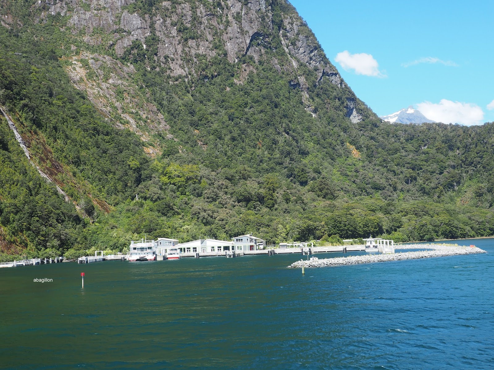
Then into beech forests, past tranquil lakes and crystal clear rivers as we climb steadily into the very heart of the mountains. Passing through mist covered valleys, carved out by rock and ice to reach the Homer Tunnel, the gateway to Milford Sound is through a huge mountain. Starting our descent into Milford Sound we travel from cloud capped forest peaks into the subtropical west coast valleys of Milford Sound. We arrive at Milford Sound at approximately 1pm.

We then embark on a 1hr 45 minute cruise of the Milford Sound before leaving for Queenstown at approx. 2.45pm. We stop at Te Anau again for 20 minutes or so on the way back, and arrive back in Queenstown at 7.30pm.


From the laminated guide at the bus seat pockets, i want to read it fully but 
not able to do so, as i might miss the sceneries outside the running bus.

Our Nakedbus

the bus' glass roof, it was a lovely day

circuitous road along the Lakes, on of which is Lake Te Anau

 i will not miss posting this rainbow on that frosty mountain top

 cattle and sheep grazing on the flatlands along the way

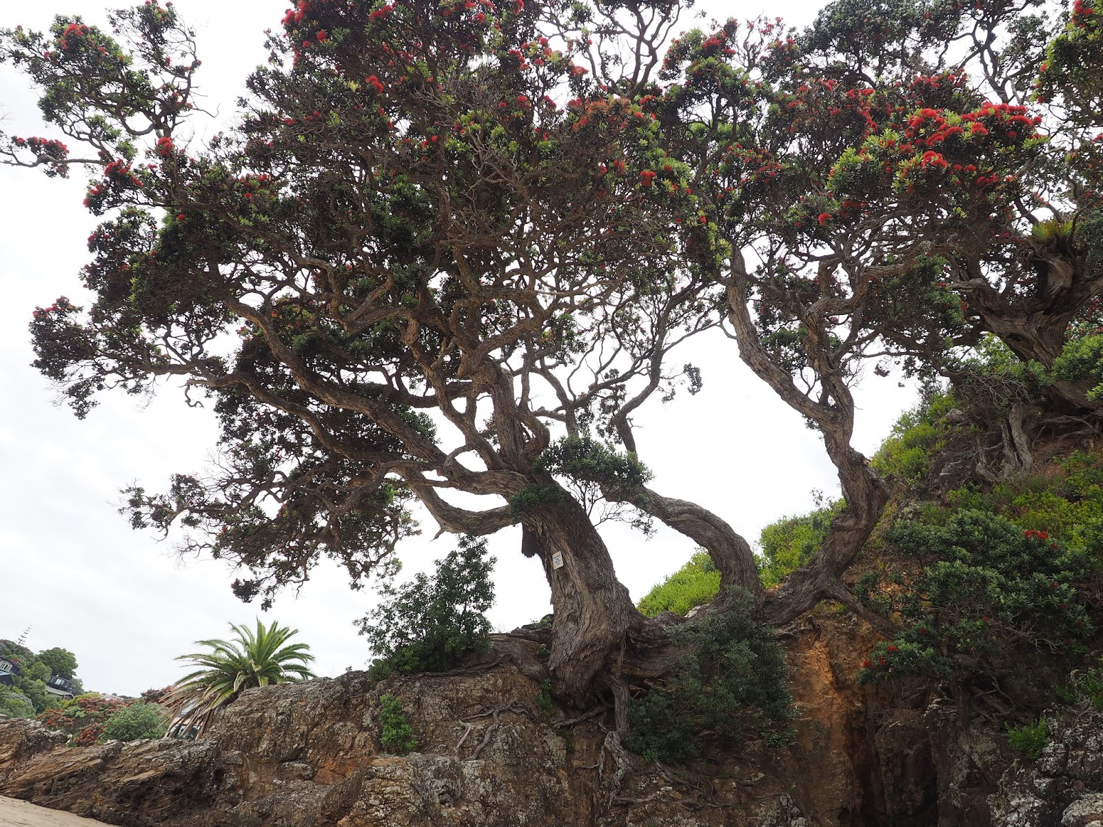
 How do you like those trees at the ridge?I wont let that pass without notice!

 and i find those grasses interesting

A little stop at Te Anau center for some snacks gave me some flowers. And what 
do you think that man is doing at the center aisle? If only we have time to spare, 
i will approach him and ask!

Along the lakes are wonderful profuse growths of lupines, i wished we stopped here 
to get better photos of these growths, i've read that the scene is one 
of the spectacular sights at South Island. 

This is near the Monkey Creek, where the driver-guide enticed us to drink. He said it is 
one of the few places you can safely drink natural water at its purest. We tried a little 
and eventually throw the original contents of our water bottles because 
it really tastes so pure, almost sweet because of its purity. 

 How about those waterfalls at the center of these forests? This sight occurred
seemingly often along this route, as a lot of waterfalls are scattered left and right.
But we need to stop and get that longer lens, which i didn't carry,
and we didn't stop! lol

 This is labeled as the Mirror Lakes, where the mountains clearly manifest
on the water during clear days. That day however, it was cloudy
and we only saw the mirror.

I am awed at the properly constructed walks to the designated stops. Safety 
of the tourists is very well accounted for. I truly felt envy 
at theseprecautions and developments. 

 We stopped at this area, a protruding layby-lookout is built at the side of the road. 

 There is a waterfalls below that river, we just heard the sound but it is fully covered by the forest.

Rapid change in types of vegetation is seen in this landscapes. Our very talented 
and humorous driver guide said if we are in a continent, we passed by the 
Great Continental Divide, but since it is not a continent we can say we passed the
 Great Divide because of the sudden obvious change in vegetation.

 Every type of geographical landscape is seen on this route, maybe except for a desert. 
Lakes, flat farms, undulating farms, green forests, mossy forests, rocky mountains,
 snowy mountains,mountains with snowcaps, mountains with icebergs. 
OMG what i read at the internet about these areas are all true! 
They are even more awesome in real life! 

Homer Tunnel, a 1.2 km  route carved out of towering mountains, a stunning feat
of engineering technology. Above is on our way back from Milford Sound,
because i wasn't able to take its photo at the other side. It is 8km south
of The Chasm, carved out of towering mountains,
a stunning feat of engineering.

the glaciers on top of the mountains


Left is an enlarged lake viewed from the lookout i mentioned above; Right is the flowing waterfalls
 at The Chasm, a very deep partition of the earth with a series of uniquely shped rocks and potholes formed by the Cleddau River through the narrow abyss. The Chasm is 8km before reaching Milford Sound, is reached through a few minutes nature walk. The waterfalls is not seen fully because 
of the rocks covering it, but the roar signifies a tall big drop. There is a constructed bridge 
on top of the Chasm for people to see fully and feel the depth and power of the water. 
In my case, for my fear of heights, my knees felt like buckling off and i wasn't able 
to keep pace with my companions, felt like melting. 


To be continued with Milford Sound Cruise!


Related Posts with Thumbnails